Accuracy is more important than speed in news communication and should be primary in the minds of communicators: Union Minister Shri Anurag Thakur
For responsible media organisations maintaining public trust should be the highest guiding principle: Shri Anurag Thakur
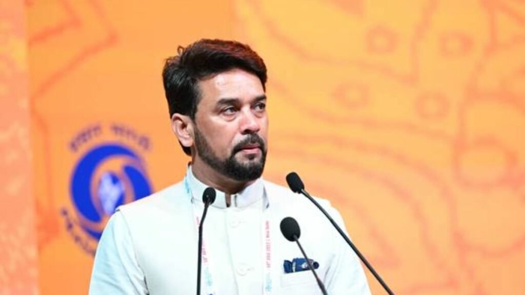
Union Minister of Information and Broadcasting Shri Anurag Thakur has today said that, “presenting authentic information is the prime responsibility of media and that facts should be properly checked before they are put in the public domain”.
Speaking at the Opening Ceremony of the Asia-Pacific Broadcasting Union General Assembly 2022, the Minister said, “while the speed with which the information is transmitted is important, accuracy is even more important and should be primary in the minds of communicators”. With the spread of social media, fake news has also proliferated, the Minister added. To that end, he informed the audience of broadcasters from the Asia-Pacific region that the Government promptly established the Fact Check Unit in the Press Information Bureau of the Government of India to counter unverified claims and present the truth to the people.
The Minister highlighted that for responsible media organizations maintaining public trust should be the highest guiding principle. He credited public broadcasters Doordarshan and All India Radio for having always stood by the truth and won people’s trust for their truthful reporting. He underlined that the media’s role during the time of crisis becomes critical as it directly concerns saving lives adding that media is at the core of national disaster management plans.
Shri Anurag Thakur also credited the media for coming to the aid of people stuck at home during the COVID-19 pandemic saying it was the media that connected people with the outside world. He informed the audience of the stellar work done by Doordarshan and All India Radio in particular and the Indian media in general saying Doordarshan and All India Radio, very satisfactorily delivered on their mandate of public service and stood strong with the people during the time of the pandemic.
Indian media, he said, in general, ensured that COVID-19 awareness messages, important government guidelines and free online consultations with doctors reached everyone in the nook and corner of the country. The Prasar Bharati lost over a hundred members to COVID-19 and yet it did not deter the organisation from carrying on with its public service mandate, the Minister said.
Shri Thakur invited the media to become a partner in Governance and used the podium to reiterate the words of Prime Minister Shri Narendra Modi that “Media should act as a link between government and people and provide continuous feedback, at both national and regional level”. He further urged that ABU as an association of broadcasting organizations must continue to train and equip media practitioners with the best professional skills on the role of media in the time of crisis and promised that India was ready for all such efforts.
The Minister also deliberated on the collaborations and partnerships India has with ABU members and said that NABM, the apex training institute of Prasar Bharati is closely collaborating with ABU Media Academy in organising training covering various aspects of the broadcast industry. India has bilateral agreements in the areas of content exchange, co-production, capacity building, etc. with about 40 countries, a number of them being fellow ABU countries such as Australia, Bangladesh, Bhutan, Fiji, Maldives, Nepal, South Korea, Thailand and Vietnam. “We have also partnered with Australia in the field of broadcasting in March 2022 for programme sharing. The broadcasters of the two countries are also exploring opportunities in co-production and joint broadcasting of programmes spanning multiple genres”, he further added.
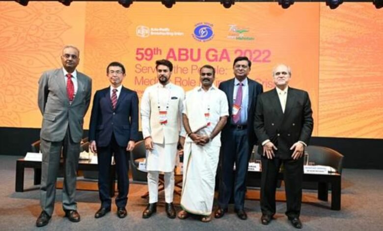
Speaking on the occasion, Mr Masagaki outlined the important role being played by ABU in Asia pacific region and appreciated the collaborated efforts being made by all public service broadcasters of the region in sharing news of public importance among themselves.
Mr Javad Mottaghi speaking on the occasion said that the region is full of diversity yet all member countries find commonality and display true unity in such wide diversity. Shri Gaurav Dwivedi, CEO, of Prasar Bharati, in his welcome address, appreciated the role of ABU in promoting the collective interests of television and radio broadcasters and regional and international cooperation between broadcasters in the Asia Pacific Region. He further said that India proudly celebrates 2022 as the 75th anniversary of its Independence from colonial rule through the Azadi Ka Amrit Mahotsav initiatives in various sectors and this conference is a great opportunity to share the achievements of the country in the sector of media and communication and showcase the rich heritage, vast diversity and progressive India to the world.
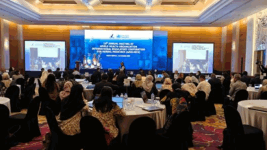
Prasar Bharati, India’s Public Service Broadcaster, is hosting the 59th ABU General Assembly 2022. The theme for this year’s assembly is “Serving the People: Media’s Role in Times of Crisis”. The General Assembly was Inaugurated today by Hon’ble Minister of Information and Broadcasting Shri Anurag Singh Thakur in New Delhi in the presence of Minister of State for Information & Broadcasting Dr L Murugan, Shri Apurva Chandra, Secretary, I&B, Mr Masagaki Satoru, President ABU and Mr Javad Mottaghi, Secretary General, ABU. The ABU (Asia Pacific Broadcasting Union) is a nonprofit, professional association of the broadcasting organizations of Asia and the Pacific region. More than 300 international delegates from 40 countries representing 50 organizations are participating in the event.
Disclaimer: This is an official press release by PIB.